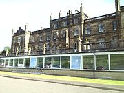
Donald's Quay
Human settlement in ScotlandDonald's Quay was once the location of the northern terminus of the Erskine Ferry then run by Lord Blantyre of Erskine House that provided foot passengers with a crossing of the River Clyde, giving direct access between Dunbartonshire and Renfrewshire. At some point in the early 19th century the northern terminus of the Erskine Ferry moved to a site closer to Old Kilpatrick and opposite the Ferry House at Erskine, before closure in 1971 when the Erskine Bridge was completed. Donald's Quay once had an approximately 170-foot-long (52-metre) stone pier that was used by coal boats that transferred their loads into canal barges on the Forth & Clyde Canal at Ferrydyke Wharf and thereby avoided paying fees at the Bowling Basin. The quay was demolished during the construction of the Lanarkshire and Dumbartonshire Railway in 1896.


